
Search
Climatic conditions are a key determinant of malaria transmission intensity, through their impacts on both the parasite and its mosquito vectors. Mathematical models relating climatic conditions to malaria transmission can be used to develop spatial maps of climatic suitability for malaria. These maps underpin efforts to quantify the distribution and burden of malaria in humans, enabling improved monitoring and control.
To effectively inform infectious disease control strategies, accurate knowledge of the pathogen's transmission dynamics is required. Since the timings of infections are rarely known, estimates of the infection incidence, which is crucial for understanding the transmission dynamics, often rely on measurements of other quantities amenable to surveillance.

Honorary Team Member
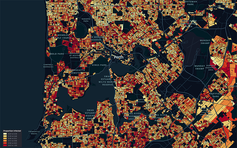
WA’s current Omicron COVID-19 outbreak could jump by 147,000 cases if mask mandates are abandoned before the Easter long weekend, according to sophisticated new modelling.
A regional corner of Africa is a hotspot for cases of HIV, tuberculosis and malaria, prompting researchers to call for targeted health support rather than a national response.

Our Child Health Analytics Team uses cutting-edge technologies to better understand how and why the health and wellbeing of children varies from place to place. We develop innovative geospatial methods that can harness large, complex datasets to pinpoint hotspots of elevated risk, evaluate change through time, and explore underlying drivers.
Post-tuberculosis (TB) sequelae present a significant challenge in the management of TB survivors, often leading to persistent health issues even after successful treatment. Identifying risk factors associated with post-TB sequelae is important for improving outcomes and quality of life of TB survivors. This systematic review and meta-analysis aims to identify risk factors associated with long-term physical sequelae among TB survivors.
Malaria imposes a significant global health burden and remains a major cause of child mortality in sub-Saharan Africa. In many countries, malaria transmission varies seasonally. The use of seasonally-deployed interventions is expanding, and the effectiveness of these control measures hinges on quantitative and geographically-specific characterisations of malaria seasonality.
Nipah virus is a zoonotic paramyxovirus responsible for disease outbreaks with high fatality rates in south and southeast Asia. However, knowledge of the potential geographical extent and risk patterns of the virus is poor. We aimed to establish an integrated spatiotemporal and phylogenetic database of Nipah virus infections in humans and animals across south and southeast Asia.
As both mechanistic and geospatial malaria modeling methods become more integrated into malaria policy decisions, there is increasing demand for strategies that combine these two methods. This paper introduces a novel archetypes-based methodology for generating high-resolution intervention impact maps based on mechanistic model simulations. An example configuration of the framework is described and explored.